

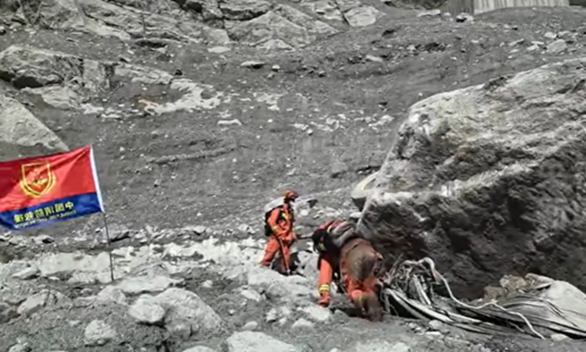
By Global Times – Why did the devastating Nepal mudslide occur, and what caused it to rapidly intensify? A joint research team led by the Institute of Tibetan Plateau Research under the Chinese Academy of Sciences (CAS) has made new progress in studying the mechanisms behind the August 2026 disaster, the Xinhua News Agency reported on Tuesday.
On the morning of August 26, 2026, a massive ice-rock avalanche occurred in a high-altitude area on the northern slope of Langtang Lirung in Nepal. The collapsed material rushed at high speed through a deeply incised valley before evolving into a destructive mudslide that struck Gyirong Port in China’s Xizang region, causing heavy casualties and extensive damage to infrastructure.
Following the disaster, the National Tibetan Plateau Data Center under the CAS Institute of Tibetan Plateau Research quickly launched an emergency response. By integrating remote-sensing observations, baseline data and model simulations, researchers conducted a rapid assessment of the disaster’s evolution, affected areas and potential subsequent risks.
Building on this work, the research team combined satellite imagery taken before and after the disaster, topographic data, seismic station records, on-site surveillance footage and other video materials. Using a unified spatial and temporal framework, the researchers reconstructed the entire disaster chain, from “source-area destabilization and high-altitude collapse to valley entrainment, impact on the port and downstream spread.”
Researchers said the study not only identified what happened during the disaster, but also sought to explain why it occurred and why its destructive power increased so dramatically.
The study found that precipitation in the source area had generally been below normal in the months before the disaster, with no significant heavy rainfall immediately preceding the event.
Instead, the researchers found that years of relatively rapid glacier movement and the continued transport of ice toward the glacier terminus, combined with warmer-than-usual conditions during the spring and summer before the disaster, increased meltwater and permafrost degradation at high elevations and may have jointly weakened the stability of the ice-rock interface. This could have eventually caused the glacier to suddenly destabilize after a prolonged period of evolution.
The available evidence is not yet sufficient to identify a single, definitive immediate trigger, researchers said. However, the findings indicate that the disaster was not simply triggered by a short period of intense rainfall.
Another key finding was that the scale of the eventual destruction was determined not only by the volume of the initial collapse, but more importantly by the substantial entrainment of additional material as the debris traveled downstream.
According to the study, erosion and entrainment along the flow path were not merely secondary processes following the initial collapse, but crucial factors determining the intensity of the disaster downstream.
As ice and rock debris traveled through roughly 22 kilometers of valley, it continuously scoured the channel bed, incorporated material from the channel and valley slopes, and interacted with river water. This process transformed an initial high-altitude ice-rock avalanche into a massive mudslide capable of causing devastating damage at Gyirong Port.
The researchers also detected potentially significant signals in the hours preceding the main event. Seismic station records showed several relatively clear anomalous signals in the source area hours before the main collapse, some of which occurred at around the same time as small-scale ice and snow movements observed on site.
The findings suggest that several smaller episodes of material movement may have occurred in the source area before the large-scale destabilization.
The research team said these signals still need to be assessed using data from multiple seismic stations, infrasound observations and video footage. Nevertheless, they could provide new clues for identifying short-term destabilization processes in high-mountain glaciers and exploring potential approaches to monitoring and early warning for such disasters.
The study noted that against the backdrop of climate warming, risk assessments for cryospheric disasters in high-altitude and cold regions should no longer focus solely on estimating the volume of material in an individual source area.
Instead, researchers called for a comprehensive assessment covering the entire disaster chain – from the stability of the source area and the potential for additional material to be entrained along transport pathways to the exposure of people and infrastructure downstream.
In other words, the researchers said, the actual level of risk depends not only on “how much material collapses from the mountain,” but also on “how much more material can be incorporated along the valley” and “what critical infrastructure and populations lie in the path of the resulting disaster chain.”
Experts said the disaster offered a clear example of how instability in a high-mountain glacier can rapidly evolve through erosion and the entrainment of additional material along its path into a highly destructive mudslide threatening downstream valleys.
The research provides an important scientific basis for emergency rescue operations, post-disaster assessments and reconstruction following the disaster. It also offers new scientific support for cross-border disaster monitoring and early warning, risk assessment, and coordinated prevention and response efforts across the Himalayan region.
The study was jointly conducted by the CAS Institute of Tibetan Plateau Research, Yunnan University, the Chinese University of Hong Kong, Wuhan University, Central South University, the China Aero Geophysical Survey and Remote Sensing Center for Natural Resources, the CAS Northwest Institute of Eco-Environment and Resources, the CAS Aerospace Information Research Institute, the International Research Center of Big Data for Sustainable Development Goals, and other institutions.
The findings were published on Tuesday in the academic journal Chinese Science Bulletin.